Carroll County, Maryland
| Carroll County, Maryland | ||
|
||
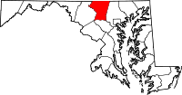 Location in the state of Maryland |
||
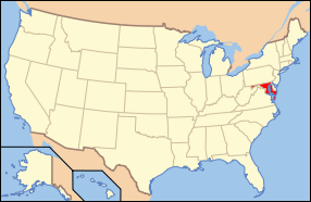 Maryland's location in the U.S. |
||
| Founded | 1837 | |
|---|---|---|
| Seat | Westminster | |
| Largest CDP | Eldersburg | |
| Area - Total - Land - Water |
452 sq mi (1,171 km²) 449 sq mi (1,163 km²) 3 sq mi (8 km²), 0.72% |
|
| Population - (2000) - Density |
150,897 337/sq mi (130/km²) |
|
| Website | www.carr.org | |

Carroll County is a county located in the U.S. state of Maryland. In 2000, its population was 150,897. It was named for Charles Carroll of Carrollton (1737-1832), signer of the American Declaration of Independence. Its county seat is Westminster.
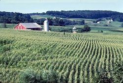
This county is a part of the Baltimore-Washington Metropolitan Area. While predominantly rural, the county has become increasingly suburban in recent years.
Contents |
History
Carroll County was created in 1837 from parts of Baltimore and Frederick Counties, see Hundred (division).
During the American Civil War, the population of Carroll County was sharply divided between supporters of the Union and the Confederacy. In 1863, there were significant troop movements through the county as part of the Gettysburg campaign. On June 29, 1863, the cavalry skirmish known as Corbit's Charge was fought in the streets of Westminster, when two companies of Delaware cavalry attacked a much larger Confederate force under General J.E.B. Stuart.
Notable citizens of Carroll County include:
- Francis Scott Key, author of the Star Spangled Banner, was born at his family plantation of Terra Rubra, in what is now northwestern Carroll County.
- Whittaker Chambers, former communist and accuser of Alger Hiss
The county has a number of properties on the National Register of Historic Places.[1]
Law and government
Carroll County is governed by three county commissioners, the traditional form of county government in Maryland.
Several times in the past, Carroll County voters have rejected charter amendments that would call for a government consisting of a County Executive and a County Council.
In 2004 Carroll County voters approved legislation that will expand the number of County Commissioners from three to five. The five Commissioners will be elected from five Commissioner districts, as opposed to three Commissioners elected at-large. This change will occur beginning with the 2010 elections. The change was to take effect beginning with the 2006 elections, but the Maryland General Assembly could not agree on the districts.
The incoming commissioners are:
- Julia Walsh Gouge, President of the Commission, former mayor of Hampstead
- Dean L. Minnich, from Westminster
- Michael Zimmer, a Mount Airy Lawyer
Republicans hold every county-wide elected office.
The current elected Sheriff is Kenneth L. Tregoning.
Geography
According to the U.S. Census Bureau, the county has a total area of 452 square miles (1,172 km²), of which 449 square miles (1,163 km²) is land and 3 square miles (8 km²) (0.72%) is water.
Carroll County is bordered on the north by the Mason-Dixon Line. The Patapsco River forms its southern border, and Liberty Reservoir forms part of its eastern border. Carroll County is bordered on the west by the Monocacy River and Sam's Creek. Other major streams include Big Pipe Creek, Little Pipe Creek, Bear Branch, and the headwaters of the Gunpowder River. The Piney Run Reservoir is in the southern part of the county.
The terrain consists of largely of rolling piedmont hills. The most significant of these is Parrs Ridge, which bisects the county from southwest to northeast. The highest point is in the northeastern part of the county on Dug Hill along Deep Run Road.
There are three railroad lines that transit Carroll County. The old Baltimore and Ohio (B&O) Old Main Line crosses the southern part of the county, with former stations in Sykesville and Mount Airy. The original Western Maryland Railway (WM) main line track goes through Carrollton, Westminster, New Windsor, and Union Bridge. The old Baltimore and Hanover Railroad (later acquired by WM) goes through Hampstead, Millers, and Lineboro. Two of the three railroad lines are currently operated by CSX Transportation, with the former WM main line being operated by Maryland Midland Railway.
Major Highways
 State Route 26
 State Route 27
 State Route 32
 State Route 91
 State Route 97
 State Route 140
 State Route 194
Adjacent counties
- York County, Pennsylvania (northeast)
- Baltimore County (east)
- Howard County (south)
- Frederick County (west)
- Adams County, Pennsylvania (northwest)
Demographics
As of the census[2] of 2000, there were 150,897 people, 52,503 households, and 41,109 families residing in the county. The population density was 336 people per square mile (130/km²). There were 54,260 housing units at an average density of 121 per square mile (47/km²). The racial makeup of the county was 95.69% White, 2.28% Black or African American, 0.22% Native American, 0.75% Asian, 0.02% Pacific Islander, 0.31% from other races, and 0.73% from two or more races. 0.99% of the population were Hispanic or Latino of any race. 30.5% were of German, 14.0% Irish, 11.1% United States or American, 10.7% English and 7.3% Italian ancestry according to Census 2000.
There were 52,503 households out of which 39.70% had children under the age of 18 living with them, 66.50% were married couples living together, 8.30% had a female householder with no husband present, and 21.70% were non-families. 17.50% of all households were made up of individuals and 7.40% had someone living alone who was 65 years of age or older. The average household size was 2.81 and the average family size was 3.18.
In the county the population was spread out with 27.70% under the age of 18, 7.00% from 18 to 24, 30.60% from 25 to 44, 23.90% from 45 to 64, and 10.80% who were 65 years of age or older. The median age was 37 years. For every 100 females there were 97.40 males. For every 100 females age 18 and over, there were 94.00 males.
The median income for a household in the county was $60,021, and the median income for a family was $66,430 (these figures had risen to $78,912 and $90,376 respectively as of a 2007 estimate[3]). Males had a median income of $44,191 versus $30,599 for females. The per capita income for the county was $23,829. About 2.70% of families and 3.80% of the population were below the poverty line, including 4.00% of those under age 18 and 4.90% of those age 65 or over.
Cities and towns
This county contains the following incorporated municipalities:
- 3 Cities:
- Westminster (incorporated 1818)
- Taneytown (incorporated 1836)
- Sykesville (incorporated 1904)
- 5 Towns:
- Manchester (incorporated 1834)
- New Windsor (incorporated 1843)
- Union Bridge (incorporated 1872)
- Hampstead (incorporated 1888)
- Mount Airy (incorporated 1894) (This town is partly in Carroll County, partly in Frederick County, Montgomery County and Howard County.)
Unincorporated areas are also considered as towns by many people and listed in many collections of towns, but they lack local government. Various organizations, such as the United States Census Bureau, the United States Postal Service, and local chambers of commerce, define the communities they wish to recognize differently, and since they are not incorporated, their boundaries have no official status outside the organizations in question. The Census Bureau recognizes the following census-designated places in the county:
- Eldersburg
Other unincorporated communities include:
- Alesia
- Carrollton
- Carrolltowne
- Detour
- Finksburg
- Frizzelburg
- Gamber
- Gaither
- Greenmount
- Harney
- Henryton
- Jasontown
- Keymar
- Lineboro
- Linwood
- Louisville
- Marriottsville (a portion is also in Howard County.)
- Middleburg
- Millers
- Patapsco
- Silver Run
- Union Mills
- Uniontown
- Woodbine (a portion is also in Howard County.)
- Woodstock (a portion is also in Howard County.)
Public schools
The Carroll County Public Schools School system is the ninth largest school district in the state of Maryland.
Economy
JoS. A. Bank Clothiers has its headquarters in an unincorporated area in the county, near Hampstead.[4][5]
Law Enforcement
Law enforcement services for the county are provided by the Carroll County Sheriff's Office, Maryland State Police, as well as several municipalities having their own police forces. In addition to providing police services, the Sheriff's Office also acts as an agent of the courts: serving warrants, enforcing child support laws, ensuring courthouse security, transporting prisoners, etc. On October 4th, 2007, the County Commissioners voted to create a police department for the county. The police department would handle primary law enforcement duties while the Sheriff's office would continue to act under the arm of the courts. This move would give the Commissioners power to appoint or fire the chief of police instead of having a popularly elected Sheriff being in charge of all law enforcement. This move falls in line with Maryland's more populated counties who have such a dual system of law enforcement (Montgomery, Anne Arundel, Prince George's, Howard and Baltimore Counties), as Carroll County has begun to have a population increase. Municipal departments, such as Westminster Police, would be unaffected by the change. [1]
Family Support Services
General counseling, trauma-based therapy, support for victims of domestic violence, in-home aide for the adult disabled, and other assistance to Carroll County families and individuals are offered by Family and Children's Services of Central Maryland (FCS), [6][7] a private nonprofit organization with offices in Westminster, Maryland. [8][9] FCS also operates an adult day care center in Westminster. [10][11] Some services are offered without charge; others are offered on a sliding-fee scale based on income.
Miscellaneous
- The newspaper of record is the Carroll County Times.
- The county was used for scenes in the Tim Allen movie For Richer or Poorer and the Richard Gere and Julia Roberts movie Runaway Bride.
- Chris Rock stood in front of North Carroll Middle School during his speech in the movie Head of State.
References
- ↑ "National Register Information System". National Register of Historic Places. National Park Service. 2008-04-15. http://www.nr.nps.gov/.
- ↑ "American FactFinder". United States Census Bureau. http://factfinder.census.gov. Retrieved 2008-01-31.
- ↑ "Carroll County, Maryland - Fact Sheet - American FactFinder". Factfinder.census.gov. http://factfinder.census.gov/servlet/ACSSAFFFacts?_event=Search&geo_id=05000US08117&_geoContext=01000US%7C04000US08%7C05000US08117&_street=&_county=carroll&_cityTown=carroll&_state=04000US24&_zip=&_lang=en&_sse=on&ActiveGeoDiv=geoSelect&_useEV=&pctxt=fph&pgsl=050&_submenuId=factsheet_1&ds_name=ACS_2007_3YR_SAFF&_ci_nbr=null&qr_name=null®=null%3Anull&_keyword=&_industry=. Retrieved 2010-07-22.
- ↑ "Career Opportunities." JoS. A. Bank Clothiers. Retrieved on May 15, 2010.
- ↑ "Town of Hampstead Zoning Map." Town of Hampstead. Retrieved on May 15, 2010.
- ↑ "Family and Children's Services of Central Maryland - Wikipedia, the free encyclopedia". En.wikipedia.org. http://en.wikipedia.org/wiki/Family_and_Children%27s_Services_of_Central_Maryland. Retrieved 2010-07-22.
- ↑ "Family & Children's Services of Central Maryland - Welcome". Fcsmd.org. http://www.fcsmd.org/. Retrieved 2010-07-22.
- ↑ "Carroll County - Westminster Counseling Office". Fcsmd.org. http://www.fcsmd.org/locations/westminsterOffice.htm. Retrieved 2010-07-22.
- ↑ http://www.carrollcountytimes.com/articles/2008/11/17/news/local_news/newsstory4.prt
- ↑ "Carroll County - West End Place". Fcsmd.org. http://www.fcsmd.org/locations/westEndPlace.htm. Retrieved 2010-07-22.
- ↑ "Microsoft Word - Sun Article WEP Montessori.doc" (PDF). http://www.fcsmd.org/news/sun_wep_montessori.pdf. Retrieved 2010-07-22.
External links
- Carroll County, Maryland Genealogy and History
- Carroll County Government
- Carroll County Public Schools
- Carroll County Times
- Carroll County Today - Carroll County, MD News, Weather, More
- Carroll County Public Library
- Corbit's Charge
- Carroll County Business Directory
 |
Adams County, Pennsylvania | York County, Pennsylvania | |
|
| Frederick County | Baltimore County | |||
| Howard County |
|
|||||||||||||||||||||||
|
|||||||||||||||||||||||